Hotel · Catalonia
Hotel abba Sants
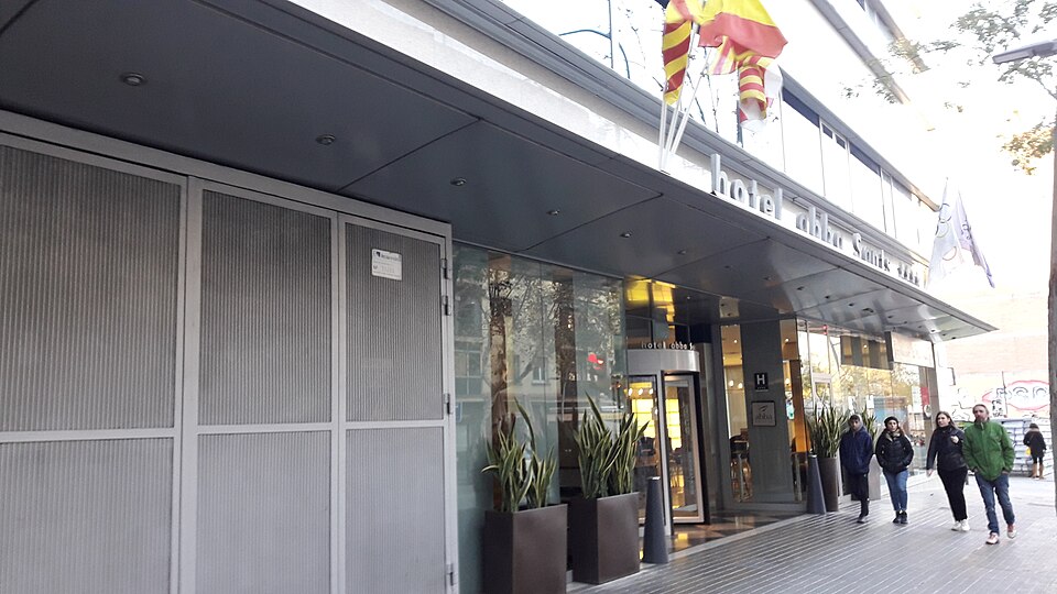
- 1minwalk to a bus stop
- 10minBarcelona–El Prat Airport · drive
- 1bars within 150 m
- 2minwalk to a supermarket
- Works without a car
At a glance
There is no beach within an hour on foot, so plan on a car, taxi or bus for the coast.
You have a bus stop about 1 minute away and a supermarket about 2 minutes away, so it works without a car.
How it compares
Compared with the 770 places we mapped in Barcelona. A longer bar means fewer places are as close.
- Walk to a bus stop 1 min Closer than 56% of places
- Walk to a supermarket 2 min Closer than 27% of places
- Drive to Barcelona–El Prat Airport 10 min Closer than 91% of places
From the hotel's website
- Gym
- Parking
- Restaurant
- Check-in from
- 14:00
- Check-out by
- 12:00
- Pets allowed
- No
- Rooms
- 140
- Stars (as stated by the hotel)
- 4
- Address
- Numancia, 32, 08029, Barcelona, Barcelona
- Phone
- +34936003100
From the hotel's own website, checked 20 Oct 2026. Confirm details with the hotel before you book. Source
How far is everything
- Nearest beach over an hour
- Bus stopNumància - Berlín 1 min
- Tram stopNumància 13 min
- SupermarketMercadona 2 min
- PharmacyFarmàcia Graham E. Joyce 2 min
- Cash machine 3 min
Sights and days out
- Camp Nou On foot: 21 min
- Casa Batlló On foot: 34 min
- Montjuïc and the Magic Fountain On foot: 44 min
- The Gothic Quarter and Barcelona Cathedral By car: 4 min
- Palau de la Música Catalana On foot: 45 min
- Sagrada Família By car: 5 min
- Park Güell By car: 6 min
- Tibidabo By car: 11 min
- Montserrat (day trip) By car: 38 min
Getting here
- Barcelona–El Prat AirportBy car: 10 min
Hills and evening noise
- Height above sea level
- about 47 m
- Climb from the nearest beach
- not known
- Average slope of that walk
- not known
- Bars and clubs within 150 m
- 1
- Bars and clubs within 300 m
- 5
Other places nearby
- Medium CityHotel 100 m away
- Ideal SantsHostel 150 m away
- Marbela apartmentsGuest house 200 m away
- NH SantsHotel 300 m away
- Via Sants Hotel Barcelona, Tapestry Collection by HiltonHotel 300 m away
- NH Sants CenterHotel 350 m away
How we worked this out
These figures are computed, not measured on foot. Walking times use the mapped streets and paths at about 4.8 km/h, with steps counted slower. Driving times use typical road speeds plus time for junctions and parking, so allow extra at busy times. The slope compares the height of the hotel with the nearest beach. "Steep" means an average of 8% or more. Noise counts mapped bars, pubs and nightclubs in a straight line.
Computed 20 Oct 2026. Map data (c) OpenStreetMap contributors, ODbL. Elevation: Open Topo Data, SRTM 30 m.
Not yet spot-checked by our editors.